Before I hit the trail, I read Cheryl Strayed’s Wild, a memoir of her time on the Pacific Crest Trail in the 1990’s. It’s a great book, but much about the trail has changed since Cheryl first set out on her own adventure, so I hadn’t been able to relate much of Cheryl’s journey to my own. In this section I finally started to experience a bit of the solitude that marked most of Cheryl’s journey.
May 12th – Day 30
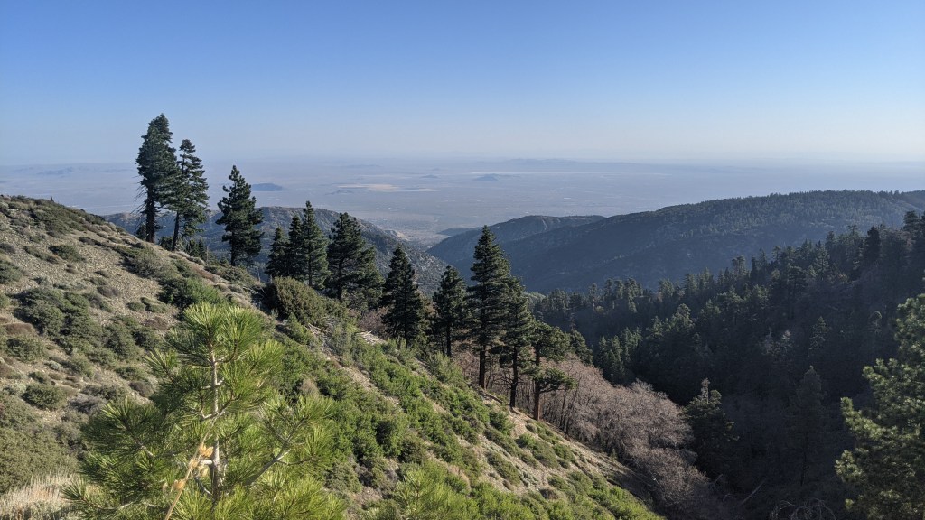
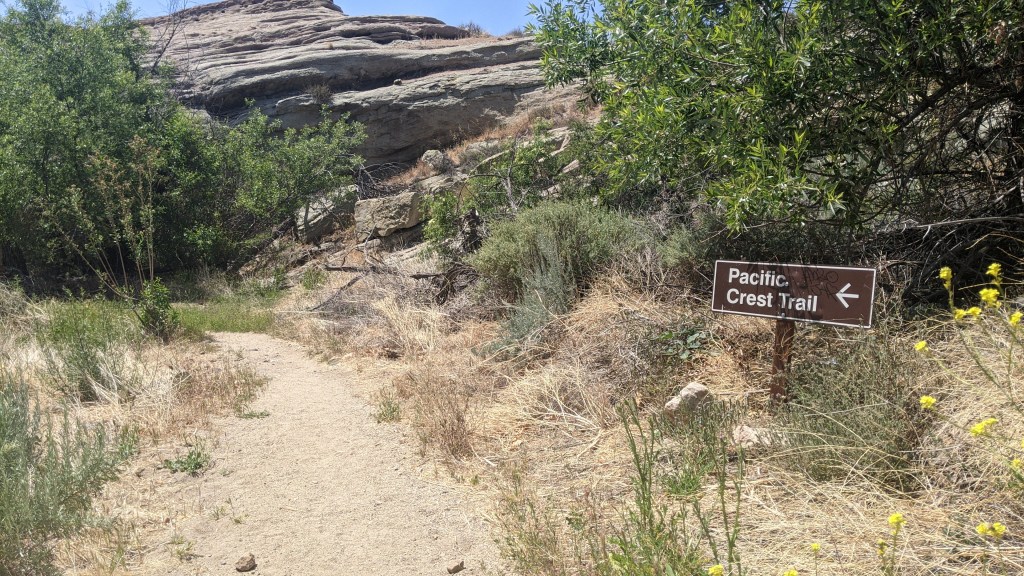
My Mom dropped me off at a completely empty Inspiration Point at 6:30 to start what would be my longest day on trail to date. Due to the Bobcat fire in 2020, the PCT is closed from Dawson Saddle to mile 401.1. This means that hikers must either hitch a ride from Vincent Gap to the Three Points trailhead or walk along Highway 2 for the same distance. Pez, Smiles, and most of the other hikers I knew in Wrightwood at the time had decided to hitch a ride around the closure. I really wanted to have a continuous footpath from Mexico to Canada on my journey, even if I couldn’t hike every mile of the PCT, so I resolved to walk on the road. I’d need to do it all in a day, as camping in the closed area is not allowed. In addition, I wouldn’t be able to listen to music because I’d be listening for cars, so I’d have nothing but my thoughts to keep me company. I was nervous; I’d gotten a later start than I’d liked and I knew I had a lot of miles to cover, but I pressed on with a steady, consistent pace. The first five miles from Inspiration Point to Vincent Gap are trail miles. Here the trail was mostly flat, with nice views of the High Desert below. I saw the first deer of my time on the PCT in this section.
I made good time to Vincent Gap, where a handful of cars were parked at the Mt Baden-Powell trailhead. The PCT to Baden-Powell is open, but the Dawson Saddle trail that would reconnect it to Highway 2 is closed, meaning that summitting Baden-Powell and walking to the closed areas and back would add an almost 14 mile out-and-back stretch. I’d hiked Baden-Powell via the PCT many times, including less than a year before, so I opted not to summit this time in order to complete the entire roadwalk in a day. I’d still have a continuous footpath from Canada to Mexico.
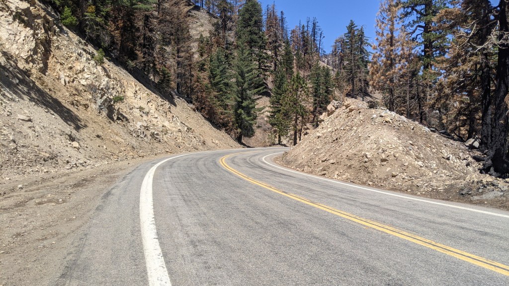
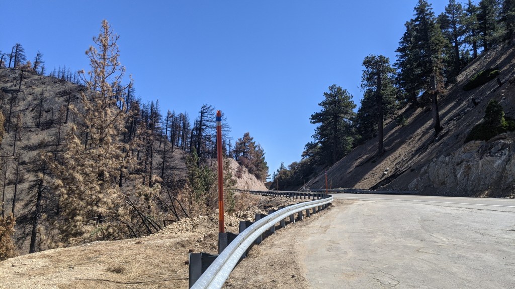
I started the roadwalk with a steady pace. It was still early and the road was empty. The first car to pass by stopped and rolled down the window. An older man asked with a concerned look on his face if I needed a ride. I thanked him but assured him that I did not. “You do know how many miles are closed, right?” he asked. I told him that I knew that I still had 20 miles to go, but I still wanted to walk. He drove away and I continued on. Highway 2 is a curvy two line road through the mountains. The views are impressive – for a road – so I had a pleasant morning on the gentle climb to Dawson Saddle.
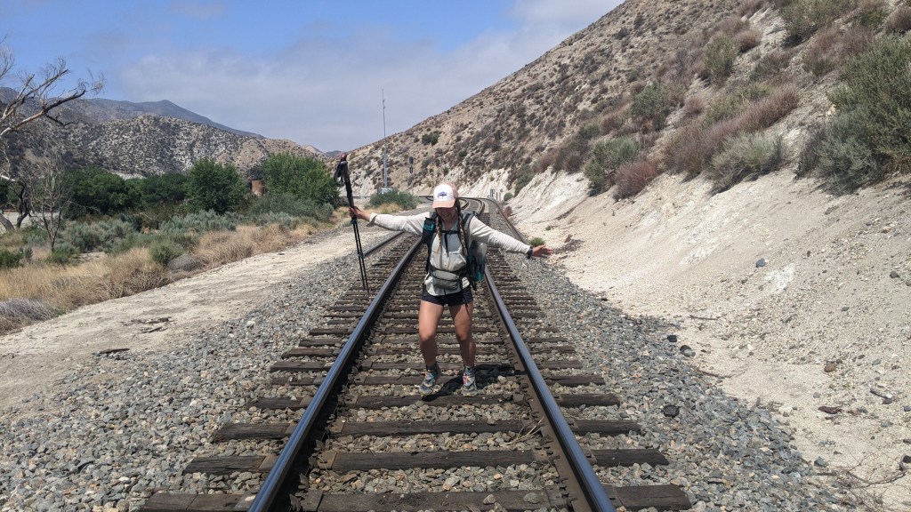
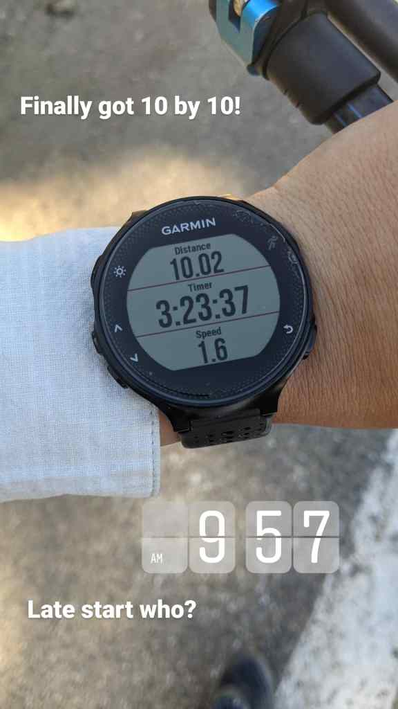
Just past Dawson Saddle at a turnout I stopped to take my first break of the day. On one side of the road the forest is green, untouched by the fire. On the other side little more than charcoal remains. I glanced at my watched and noticed that I’d already covered ten miles! And it was before 10 am! I’d finally gotten what thru-hikers refer to as a “10 by 10”, a general requirement for a big mile day. I took a picture to prove to Pez that maybe I wasn’t a “late start” after all!
I continued on my way. Soon another car drove by and stopped on the road next to me. It was a trail angel giving Caboose a ride around the closure. “How’re you doing, Fire Ant?” Caboose called from the passenger seat. “Do you need a ride?”
“No, I’m just going to walk the whole way” I responded.
“Where’s Pez? Is he in front of you?” He asked.
“I think he’s behind me, he was planning on summitting Baden-Powell and then hitching a ride.”
Caboose nodded and thought for a second. The driver asked if I needed any water or Gatorade. I assured them I had plenty and they drove off.
There was a surprising amount of water on the road to Islip Saddle, about 15 miles in, where a piped spring flowed. I checked my map, and saw one more spring marked along the road about 7 miles ahead. I still had plenty of water, so I opted to press on. Throughout the day two more cars stopped to ask if I needed a ride, and at least a dozen more slowed down enough to see if I would try to flag them down. The day wasn’t hot, and I made good time. By 4 pm I was nearing the spring on the map and the end of the road walk.
I looked for the spring but couldn’t spot it. That area of road seemed particularly dry, so I checked my map and saw that about a mile into the open trail was another piped spring. I’d have to hike a mile more than I’d planned, but I was making good time, so I wasn’t stressed about it. As I neared the end of the closure a man on a bike passed by, closely followed by a truck. He didn’t look like the cyclists I’d seen earlier in the day, he wore street clothes and no helmet. “Hey, where’d you walk from?” He asked. “Did you walk all the way from town?”
“I started from Inspiration Point!” I yelled back. He didn’t hear me and turned around to ride back. The truck behind him followed.
“Wow, that’s a long way to walk. What’d you do that for?” He asked. I told him about the PCT and the closure, and why I needed to road walk around it.
“That’s dope. You’re really going all the way to Canada, huh?” He nodded to himself and turned to the driver of the car. “How fast was I going down those hills?” He asked.
“Thirty, maybe thirty five miles an hour,” the man in the truck responded.
The man on the bike turned back to me and said “I was doing thirty-five miles an hour down these hills just now.” I nodded and congratulated him.
“Need a ride?” the man in the truck turned to me and asked.
“Nah man, she’s walking the whole way.” The guy on the bike told him. “Well good luck on your way to Canada!” And the two rode off.

I finally got to mile 401, the end of the closure, and felt very proud of myself. I still had plenty of daylight left, and all I needed to do was find water and a suitable campsite. I headed down the trail and almost immediately was swarmed by biting flies. I hiked faster to avoid them and looked for the spring. When I got there I found it dry. I started to feel very nervous. I was almost out of water and all water sources for the next 13 miles were springs. What if they were all dry? I continued on at a faster pace. The trail would intersect the road one more time at mile 403 before heading into the mountains. I could call someone and ask them to bring me water, but I didn’t have any service. Maybe I could flag down a car and ask if they had any?
I got to the intersection with the road and to my infinite relief there was a small water cache. I never thought I’d be so grateful to see a water cache, but I really needed this one. There were 6 gallons of water, 3 of which were empty, and a few cans of soda. I felt bad taking water from such a limited cache, but I hadn’t seen anyone on the road. If anyone had a right to this water, it was the road walkers, I reasoned. I took 2 liters, which would be enough to keep me alive even if all the springs were dry, and kept going.

After a mile I hopped into the first suitable tentsite I found. I’d done nearly 29 miles that day, and I was exhausted but proud. I even had quite a bit of daylight left! As I sat in my tent and browsed my paper maps after dinner I realized that I hadn’t seen a single hiker, day hiker or thru hiker, at all. Up to that point, I’d seen maybe 20-30 thru-hikers a day. I also realized that for the first time since my third night on trail, I was camping truly alone. Instead of feeling lonely, I felt empowered. Cheryl Strayed sometimes went a week without seeing another person. She relied on herself for survival and company. For the first time I started to be able to relate.
May 13th – Day 31
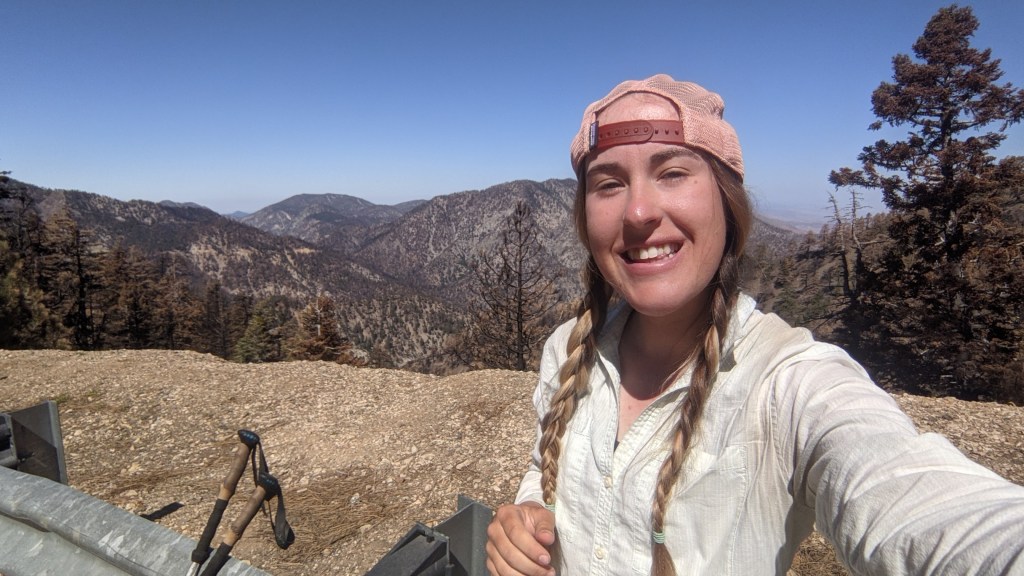
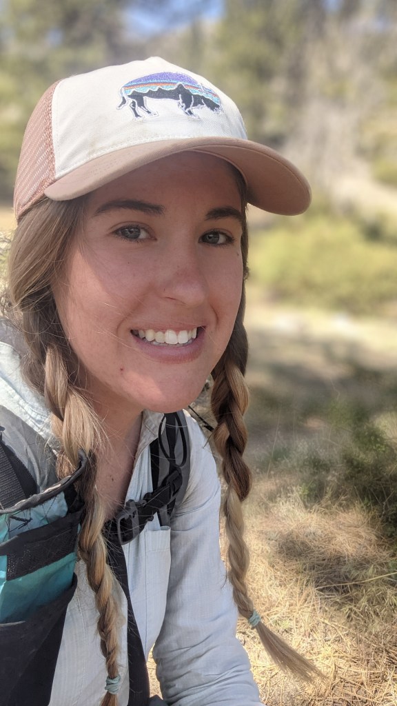
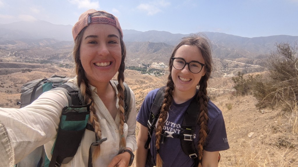
It was my One Month Trailiversary! It’s hard to believe I’ve been out here a month, but thinking back to the Southern Terminus it’s also hard to believe that I was there only a month ago. I feel like so much about how I go through my day has changed since my early days on trail. If anything, I’m certainly much more tan. I took a selfie to commemorate the day and started hiking. This portion of the trail is increasingly shrubby as the trail descends. By lunchtime I still hasn’t seen any other hikers. I thought it was odd, but I shrugged it off and took a break.

Pez came up behind me in the middle of my break. While I did the roadwalk the day before Pez hiked Baden-Powell. He spent the night in Wrightwood and had gotten a ride around the fire closure that morning. I told him he was the first hiker I’d seen in a day and a half. He was surprised, but assured me that we’d likely see many more hikers as more rides took hikers around the closure. He also said that Wrightwood was his favorite trail town so far, so my hometown made up some points!
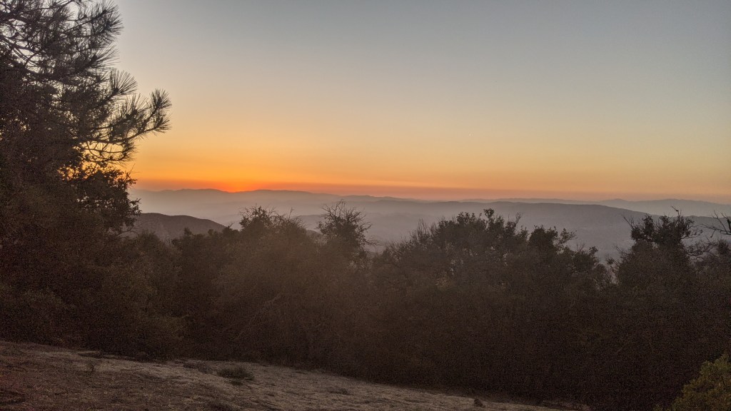
I’m the afternoon we arrived at the Mill Creek Fire Station and were surprised to find what we thought would be a popular hangout spot totally empty. “Where are all the hikers?”, Pez wondered. Maybe everyone else knew something we didn’t? We continued on to a spot with a beautiful view of the desert. Finally, more hikers started arriving and we no longer felt like we were alone on trail. The sunset was spectacular and it was a great way to end my one month trailiversary.
May 14th – Day 32
After leaving camp I almost immediately encountered overgrown trail. This part of the trail was hot, with few trees but many thorny people-high bushes reaching out to scratch hikers passing by. I made frustratingingly slow progress bushwhacking all morning.
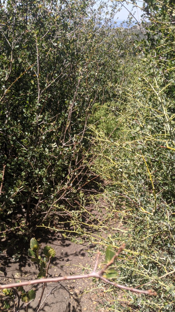
In the early afternoon I made it to the North Fork Ranger Station, where snacks and cold drinks can be purchased. It’s a popular hiker hangout. I heard from a few other hikers that due to Covid-19, scheduled trail maintenance on this section had been cancelled, leading to the overgrown trail. As a result, some hikers had opted to skip a few miles, which is why this portion of the trail was less crowded. Despite the dozens of tiny scratches on my legs, I was glad I’d stuck it out and hiked through.

Pez decided to camp at the ranger station but I hiked on a few miles. I passed an interesting duo of backpackers heading in the opposite direction. They had huge, heavy packs and said they were out mining for zinc. I learned a lot more about recreational mining than I planned to in a short conversation, but I guess accessing remote mineral deposits is one of the PCT’s many uses.

I found a truly stunning campsite big enough for only my tent. I camped alone without feeling the least bit lonely.
May 15th – Day 33
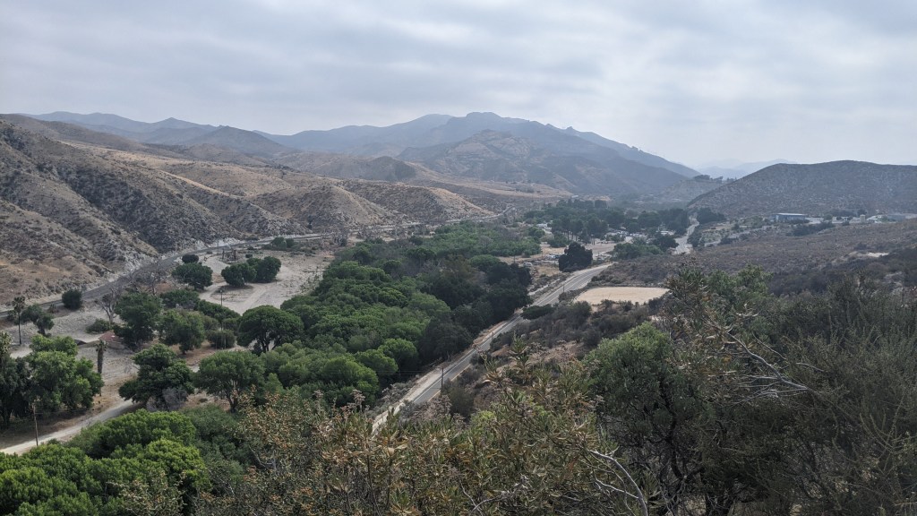
It was cold and overcast when I woke up that morning. I would be meeting my friends and sister to hike a particularly interesting portion of the trail. Despite the promise of seeing familiar faces, I wasn’t feeling very motivated to hike. I packed up late and had to rush to hike the five miles to meet my sister at the Indian Canyon Trailhead at the agreed time. The descent into Acton is pretty, and I even saw several Metrolink trains on the tracks below. After growing up near major freight train tracks, I always think it’s cool to see a “people train”.
Once I got to the trailhead and dug into the snacks my sister brought me I felt much better. Pez arrived just as Katherine told me I’d made good time that morning. “Did she, though?” Pez questioned, unimpressed with my 8:20 start. But hey, miles are miles whether they come before or after noon. Pez headed to the Acton KOA while Katherine and I packed our bags. Katherine would only be able to hike a short section with me before she had to turn around to head to work, so we set off, making good time out of Soledad Canyon Road.
After Katherine left I made quick work of the remaining 8 miles to Vasquez Rocks, where I’d meet some friends from LA. It was a nice day, not too hot, and the scenery was pretty. The bad mood I had been in in the morning disappeared. As I entered Vasquez Rocks county park I saw more and more day hikers. Many movie scenes are shot here, so it’s a popular place to visit.
As I approached what appeared to be the most popular set of rocks in a large clearing I lost the trail. The park was bigger than I’d expected, with multiple parking lots and many trails criss crossing through. I worried that I might not be able to find my friends. I asked a ranger which way the PCT went, and as she was giving directions I head music coming from a portable speaker to my left. I looked in the direction of the music and sure enough, that was my group! I ran over and flagged them down. They had just parked and were surprised to find me so soon. I was so happy to see them after a month. They looked colorful. And clean.

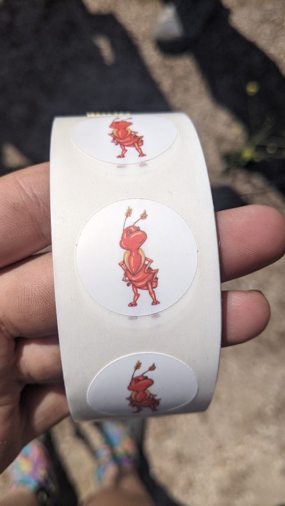
We spent the rest of the afternoon climbing the rocks and exploring the sandstone formations. I had a great time catching up and learning about everything going on back in Los Angeles. They even surprised me with Fire Ant stickers that they’d gotten me to put on my gear and on the many trail registrars I’d encounter. I was touched by their thoughtfulness and immediately put a sticker on my phone.
We got burgers and beer at a popular hiker joint in Agua Dulce. Afterwards they gave me a ride back to my apartment so that I could shower, sleep in my own bed, and see my foster cats.
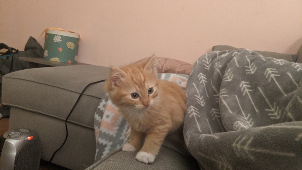
I got my latest foster cats, a mother and her single newborn kitten, a few weeks before coming out on trail. Since I left, my sister has graciously taken over foster mom duties. Now, the tiny kitten is ready for adoption! If anyone is looking for a fluffy orange ball of pure kitten energy, let me know! Mama is also up for adoption. She loves people and will demand your attention. She also loves to play and will go crazy for the lazer pointer. If you’re looking for a fluffy Calico with a lot of love to give, she’s your cat!

It was so great to be back at my apartment in LA, but I immediately recognized that it could be dangerous. If I got too comfortable, I might not leave, so I was back on trail the next morning. I still have a long way to go to get to Canada!
Until next time,
Megan “Fire Ant” Spencer

Those rocks were awesome and that was a fun day, glad we got the chance to see you!
LikeLiked by 1 person
It was so great seeing you! Can’t wait to hike with you again ❤
LikeLike
It was so great seeing you! Can’t wait to hike with you again ❤
LikeLiked by 1 person